READ THIS AGREEMENT BEFORE USING THIS CHARTED WATERS PRODUCT
THIS IS A NON EXCLUSIVE LEGAL AGREEMENT BETWEEN YOU AND CHARTED WATERS PTY LTD, ACN 166 766 427. BY PURCHASING AND USING THIS CHARTED WATERS PRODUCT, YOU AGREE TO BE BOUND TO THE TERMS OF THIS AGREEMENT.
CHANGES TO THIS LICENCE: We reserve the right to change all or part of the License at any time. If we do that, we will post the changed terms to the same web page as the old terms. IF YOU CONTINUE TO USE AN APP AFTER WE POST CHANGED TERMS, THAT USE WILL CONSTITUTE YOUR ACCEPTANCE OF THE CHANGED TERMS.
CERTAIN DEFINITIONS: As used in this Agreement, the following terms have the respective meanings provided below:
“DEVICE” means any or all of the hardware devices on which you access or use the Product, including without limitation a computer, tablet, smartphone or sounder.
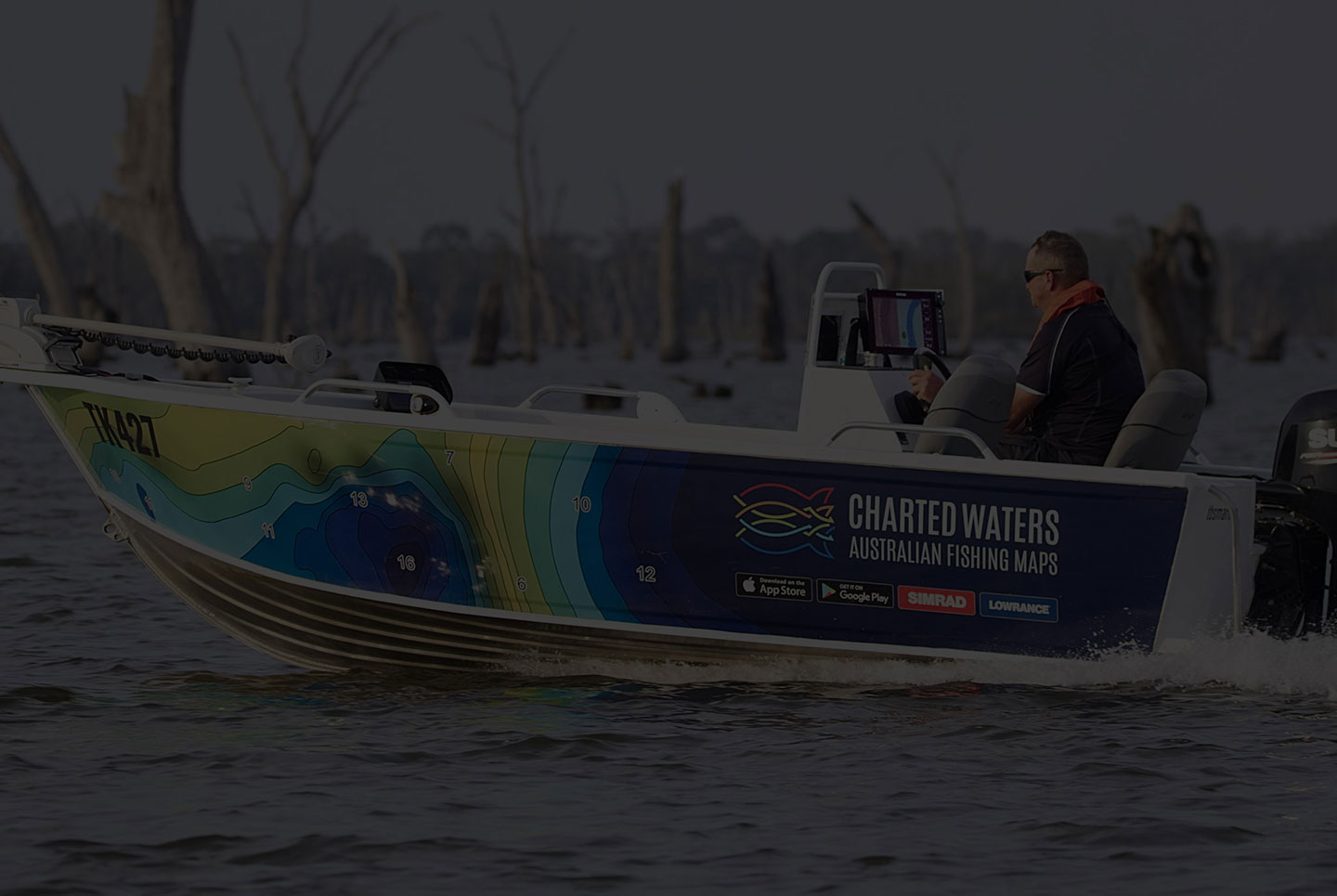
Charted Waters Pty Ltd is an Australian resident company with its registered office at 18 Jarrah Street Wodonga Victoria Australia
“PRODUCT” means an electronic chart containing cartographic, bathymetric and similar information either purchased on a secure digital memory card, subscribed to via a web service or an “app” installed on a mobile Device.
“CHARTS” means a bathymetry map layer created by surveys and sonar logs
“PUBLIC MARKERS” means edits made by Charted Waters users using Charted Waters apps and viewable on select chartplotters and on apps.
USES PERMITTED: You may use your Product on your Device as an electronic chart/map and ancillary aid to navigation (see Safety Warning below). This Agreement gives you certain limited rights to use and maintain the Product. You agree to use reasonable efforts to protect the Product from unauthorized use, reproduction, distribution or publication. In the case of Products used on mobile Devices, Charted Waters reserves the rights to take marketing initiatives, by itself or through co-marketing actions, by sending messages or causing banners to appear on your Device during use of the Product
PROHIBITED USES: You may not: (1) rent, lease, sublicense, sell, assign, loan, or otherwise transfer the product, your copy of the product or any of your rights and obligations under this License; (2) remove or obscure any copyright notices or other proprietary markings on the product; (3) reverse engineer or attempt to unlock or bypass the initialisation system or encryption techniques utilised with a product;, decompile, disassemble, modify or adapt the product, merge the product into another program, or create derivative works of the product; (4) copy or distribute the product; (5) use the App in any unlawful manner, for any unlawful purpose, or in any manner inconsistent with this License.
PUBLIC MARKERS: As used herein, “Public Markers” (PM) means any data submitted by any user of Products, using an interface included in a Product or on Charted Waters website, AND SHARED WITH CHARTED WATERS AND THE CHARTED WATERS COMMUNITY. PM may be more than one and include in separate layers and without limitation: sonar logs, points of interest (POI) and other cartographic object additions, bathymetric information, error fixing or discrepancy reports. PM may be submitted only to correct or improve Charted Waters’ charts and may not include any personal data.
Your submission of PM shall constitute your acceptance of any rules and policies as are then in effect found on Charted Waters website.
DURATION & TERMINATION: This Agreement is effective from the day you download or otherwise purchase your Product and shall continue until terminated. Your license to use Data shall terminate automatically, without notice from Charted Waters, if you fail to comply with any provision of this Agreement. Upon such termination, you must delete and destroy any Product in your possession or control. Charted Waters reserves the right to enforce any other legal rights arising from termination.
Charted Waters is not obligated to support superseded or discontinued versions of Products or to upgrade or maintain Products for use on new releases/versions of your Device or its operating system. Some or all features of your Product may fail to function on Devices other then the Device for which you originally purchased it.
DISCLAIMER: THE PRODUCT AND RELATED MATERIALS ARE LICENSED “AS IS” AND CHARTED WATERS (AND ITS AFFILIATES, CONTRACTORS, EMPLOYEES, DEVELOPERS, CLIENTS, AGENTS, SUPPLIERS, OR THIRD-PARTY PARTNERS) DISCLAIMS ANY AND ALL OTHER WARRANTIES, WHETHER EXPRESS OR IMPLIED, INCLUDING, WITHOUT LIMITATION, ANY IMPLIED WARRANTIES OF MERCHANTABILITY, FITNESS FOR A PARTICULAR PURPOSE OR NON-INFRINGEMENT. YOU ASSUME THE ENTIRE RISK AS TO THE PERFORMANCE AND RESULTS OF PRODUCT. CHARTED WATERS’S CUMULATIVE LIABILITY TO YOU OR ANY OTHER PARTY FOR ANY LOSS OR DAMAGES RESULTING FROM ANY CLAIMS, DEMANDS, OR ACTIONS ARISING OUT OF OR RELATING TO THIS AGREEMENT SHALL NOT EXCEED THE PURCHASE PRICE YOU PAID FOR THE LICENSE TO USE THE PRODUCT. IN NO EVENT SHALL CHARTED WATERS BE LIABLE FOR ANY INDIRECT, INCIDENTAL, CONSEQUENTIAL, SPECIAL, OR EXEMPLARY DAMAGES OR LOST PROFITS, EVEN IF CHARTED WATERS HAS BEEN ADVISED OF THE POSSIBILITY OF SUCH DAMAGES. SOME JURISDICTIONS DO NOT ALLOW THE LIMITATION OR EXCLUSION OF LIABILITY FOR INCIDENTAL OR CONSEQUENTIAL DAMAGES, SO THE FOREGOING LIMITATION OR EXCLUSION MAY NOT APPLY TO YOU.
GENERAL: If any provision of this Agreement is held to be invalid or unenforceable, the remainder of this Agreement shall not be affected thereby and such provision shall be substituted with a valid and enforceable provision which as nearly as possible accomplishes the intent of the original provision.
This Agreement shall be governed by the laws of the Commonwealth of Australia.
Users of Charted Waters products must comply with local laws of any location at which the product is used.
SAFETY WARNINGS: Products are designed to provide ancillary aid to navigation by facilitating the use of authorized government charts, not to replace such charts. Only official government charts and notices to mariners contain all information needed for safe navigation. The user is responsible for the prudent use of Products. Any routes generated by electronic charts, auto-routing software or similar tools are basic suggestions for route planning only and must not be used for direct navigation.
IF YOU ARE PURCHASING THIS PRODUCT THROUGH iTUNES: You acknowledge and agree that (i) this Agreement is concluded between you and Charted Waters , and not Apple, Inc. (“Apple”); (ii) Charted Waters , and not Apple, is solely responsible for the Product; (iii) Apple has no responsibility whatsoever to furnish any maintenance and support services with respect to the Product; (iv) to the maximum extent permitted by applicable law, Apple will have no other warranty obligation whatsoever with respect to the Product; (v) Apple is not responsible for any claims that you have arising out of your use of the Product; (vi) Apple will have no responsibility whatsoever for the investigation, defense, settlement or discharge of any third-party claim that the Product infringes that third party’s intellectual property rights; and (vii) Apple and its subsidiaries are third-party beneficiaries of this Agreement and, upon your acceptance of this Agreement, Apple will have the right (and will be deemed to have accepted the right) to enforce this Agreement against you as a third-party beneficiary.
DATA SOURCES:
Bathymetric Data: Source: C Charted Waters, the NSW Roads & Maritime Services, the Office of Environment and Heritage NSW.Department of Environment, Land, water and Planning and Sydney Water Monitoring Services.
Navigation Aid Data: Source: Roads & Maritime Services.Department of Environment, Land, water and Planning..
Other data: Source: Department of Environment and Primary Industries & Open Street Maps.org. Department of Environment, Land, water and Planning.
Imagery: Source: Google Earth Image © 2015 Digital Globe