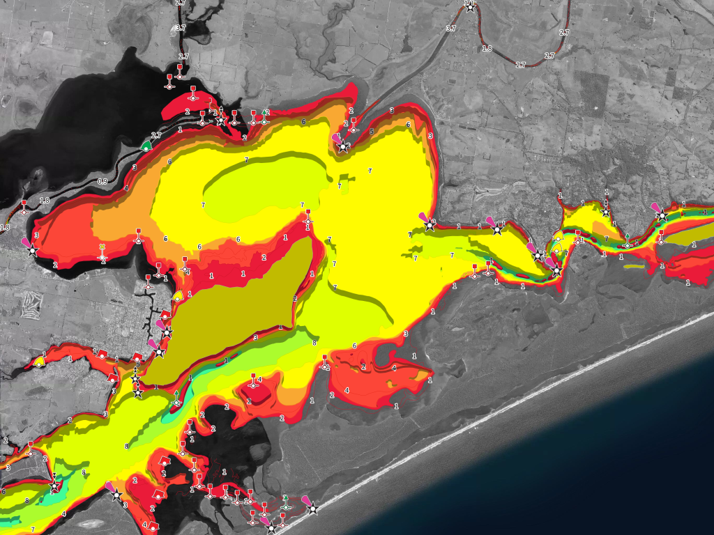
Gippsland lakes is available and also introduces our new format, with defined colour coding that clearly & crisply defines water depths, makes it much easier to find your targeted depth.
Contours are spaced at 1 meter, with shallow coded red through to deep being blue.
You may need to refresh your map list, simply drag the list downwards and it will refresh.
This chart is crisp, clear and highly visible on your device!
And if you haven't seen the new iPhone/iPad App read the New App Features and you will be able to use the app at high speed in off-line mode, create waypoints and "travel" using the new course up feature just to mention a few.