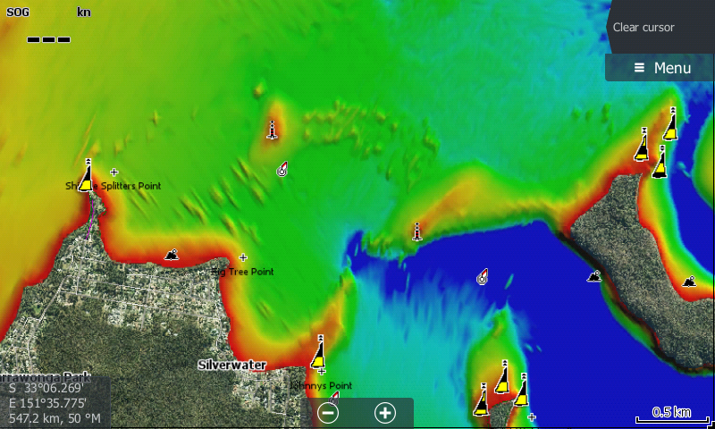
The chart for Lake Macquarie has been updated for Simrad, Lowrance HDS Gen2 (with updated software) and Lowrance Gen3 Sounders. Satellite imagery has now been included in this chart, and owners of compatible sounders are able to turn off 3D Bottom Mapping & have satellite imagery only. The imagery is that good in places you can even see the navigation markers. It's also handy for finding scattered weed beds among the flats, rocky points and adds a point of reference to your boat position in relation to the shoreline.
This is a free upgrade.
The updates apply to anyone who purchased charts prior to 11th October, to upgrade your card return it to;
Charted Waters. PO Box 983 Wodonga, Vic, 3689 with a stamped self addressed envelope, and details of your sounder model.
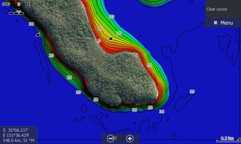
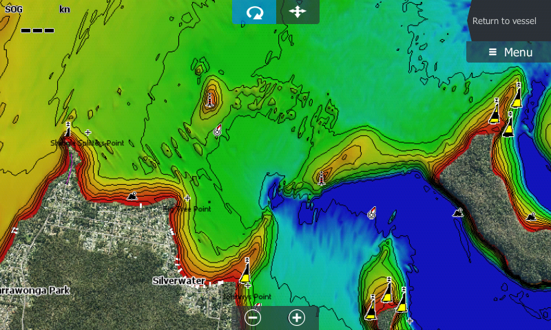
3D Bottom mapping with Satellite Imagery
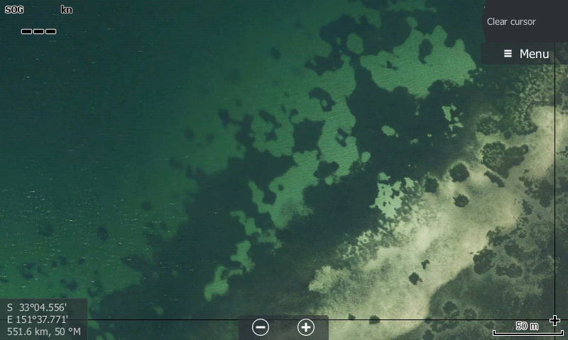
Scattered weed among the sand flats easily found.
Zoomed out view.
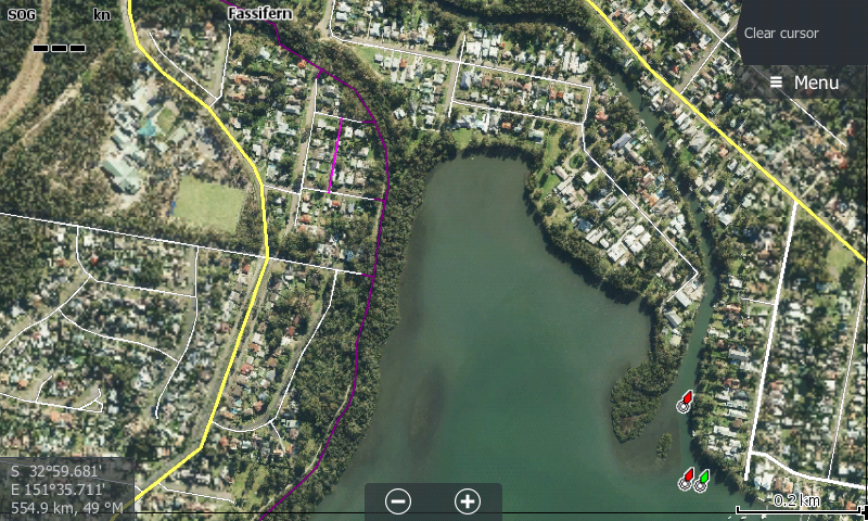
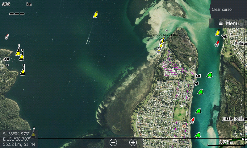
Satellite imagery now available for entire lake & surrounding shoreline.
Screen can be "cleaned up" by turning depth contours off and relying on 3D Bottom Mapping view only.
Points of reference now much easier with on water features marked as well as land imagery viewable.